Split rasters
Details
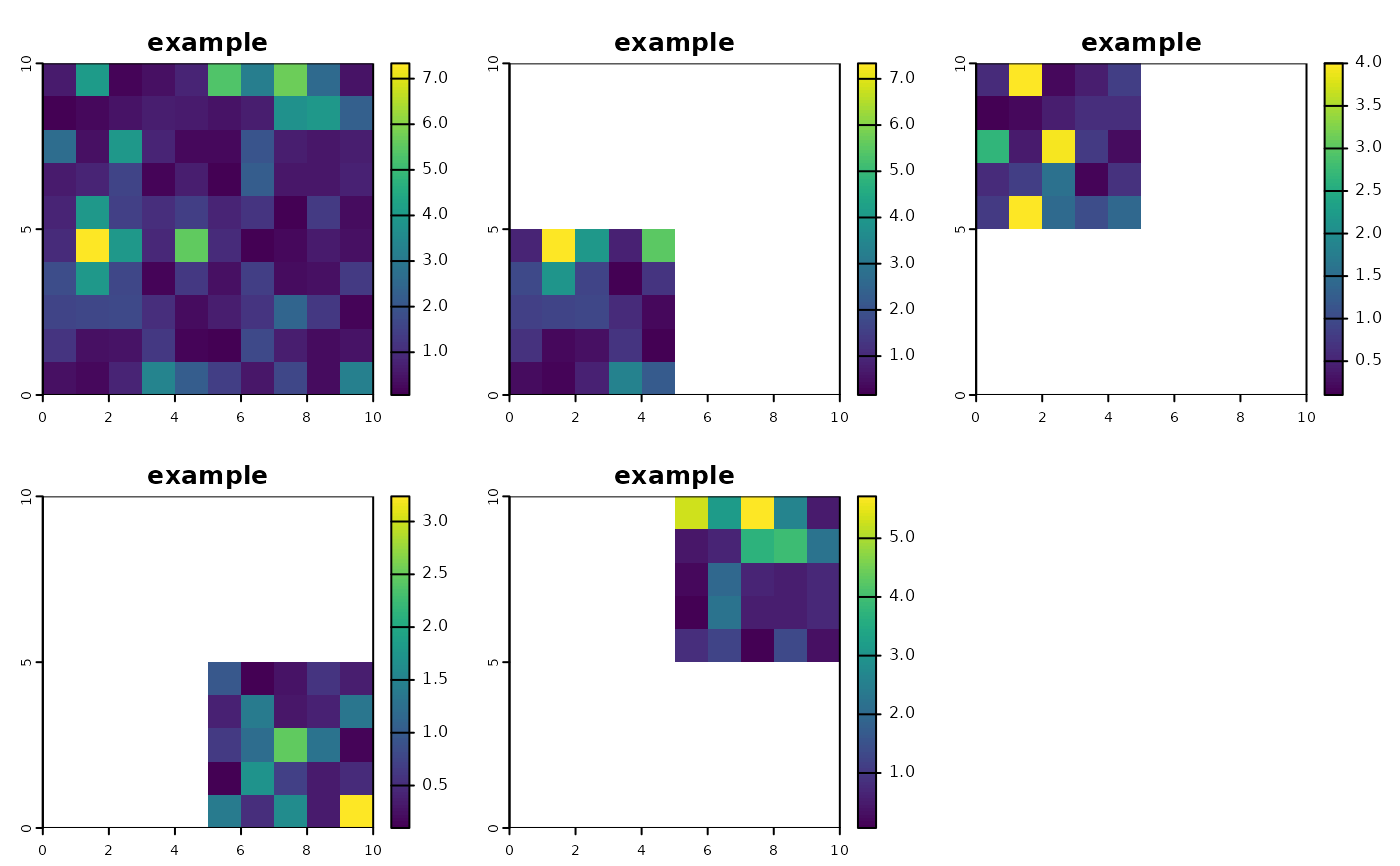
Splits a SpatRaster up into a grain^2 list of approximately equal
geographic sized rasters covering the extent of x
Examples
# Split a raster into four
library(terra)
r <- example_raster()
s <- split_rast(r, grain = 2)
s
#> [[1]]
#> class       : SpatRaster
#> size        : 5, 5, 1  (nrow, ncol, nlyr)
#> resolution  : 1, 1  (x, y)
#> extent      : 0, 5, 0, 5  (xmin, xmax, ymin, ymax)
#> coord. ref. :
#> source(s)   : memory
#> name        :   example
#> min value   : 0.1587361
#> max value   : 7.3352526
#>
#> [[2]]
#> class       : SpatRaster
#> size        : 5, 5, 1  (nrow, ncol, nlyr)
#> resolution  : 1, 1  (x, y)
#> extent      : 0, 5, 5, 10  (xmin, xmax, ymin, ymax)
#> coord. ref. :
#> source(s)   : memory
#> name        :   example
#> min value   : 0.1028045
#> max value   : 4.0001839
#>
#> [[3]]
#> class       : SpatRaster
#> size        : 5, 5, 1  (nrow, ncol, nlyr)
#> resolution  : 1, 1  (x, y)
#> extent      : 5, 10, 0, 5  (xmin, xmax, ymin, ymax)
#> coord. ref. :
#> source(s)   : memory
#> name        :    example
#> min value   : 0.09802478
#> max value   : 3.23820739
#>
#> [[4]]
#> class       : SpatRaster
#> size        : 5, 5, 1  (nrow, ncol, nlyr)
#> resolution  : 1, 1  (x, y)
#> extent      : 5, 10, 5, 10  (xmin, xmax, ymin, ymax)
#> coord. ref. :
#> source(s)   : memory
#> name        :   example
#> min value   : 0.0627102
#> max value   : 5.7145289
#>

# plot with original
 ps <- lapply(
   s,
   FUN = extend,
   y = r
 ) |>
   rast()

 c(r, ps) |>  plot()
